Evacuations from High-Risk Locations Call +44 (0)1202 308810 or Contact Us →
State of Emergency Declared Ahead of Hurricane Michael
9 Oct 2018
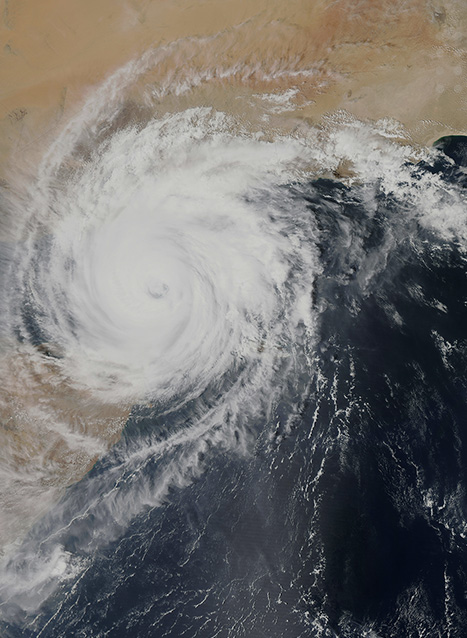
A powerful storm named ‘Michael’ has been upgraded to a Category 1 hurricane as it tracks north off Cuba’s western tip towards the United States. Hurricane Michael is expected to make landfall near Panama City in north-western Florida on Wednesday around midday local time. Authorities have declared a state of emergency and warned of strong winds, heavy rainfall and a significant storm surge along the Florida coast.
Key Points
- A powerful storm named ‘Michael’ has been upgraded to a Category 1 hurricane as it tracks north off Cuba’s western tip towards the United States
- Hurricane Michael is expected to make landfall near Panama City in north-western Florida on Wednesday around midday local time
- Authorities have declared a state of emergency and warned of strong winds, heavy rainfall and a significant storm surge along the Florida coast
SITUATIONAL SUMMARY
Environmental: A state of emergency has been declared in at least 26 counties in north-western Florida, and in coastal Alabama, in preparation for Hurricane Michael. The storm is current tracking north off the east coast of Mexico’s Yucatan Peninsula and is expected to make landfall somewhere near Panama City, Florida, on Wednesday midday local time. By then the storm is expected to have increased to a Category 2 (Saffir Simpson Scale) hurricane with wind speeds of 154–177kph (96-110mph).
Tropical storm force winds are already being recorded up to 275 kilometres (170 miles) from the centre of the storm. Prior to reaching the Gulf of Mexico, the tropical depression brought rainfall and strong winds to the north-eastern coast of the Yucatan peninsula and western Cuba. With the latter facing around 180mm (7 inches) of rainfall and hurricane force winds.
In the United States, emergency services have been warning residents that the hurricane could cause strong rip tides and other dangerous sea conditions along Florida’s west and panhandle coasts as early as Tuesday morning. If the hurricane makes landfall at the same time as high tide, storm surges of up to 3-3.5 metres (10-11 feet) could impact coastal areas. After making landfall, the hurricane is expected to track inland, reducing in intensity to a tropical storm, with heavy rainfall threatening flooding in Alabama, inland Florida and in south-east Georgia.
SOLACE GLOBAL COMMENT
Michael is expected to make landfall as a Category 2, possibly a Category 3, hurricane. While this is far weaker than Hurricane Irma that struck the region in September last year, the storm still presents a notable threat to the western Florida. As a result, the authorities have issued a Hurricane Watch Alert from Pensacola to just north of Cedar Keys with a Tropical Storm Watch Alert extending as far south as Tampa.
By implementing a state of emergency, the local authorities are ensuring that adequate measures are in place prior to the storm’s arrival. The Florida National Guard has also activated 500 guardsmen to assist with planning and logistics as well as to prepare a response in potentially impacted areas. Florida’s state governor and local government social media handles have advised residents in the impacted region to implement their emergency plans. No mandatory evacuation orders have been issued as of yet.
As the storm tracks inland, heavy rainfall could result in flooding throughout Florida, Alabama and in southern Georgia; impacting travel in the states. From there, the storm will likely continue into the Carolinas; which were impacted by Hurricane Florence last month. The storm may impact the ongoing recovery work from Florence, which is continuing in the Carolinas; numerous smaller roads remain closed as a result of the damaged caused by the previous storm.
Depending on the storm’s path, flight operation in and out of Hartsfield–Jackson Atlanta International Airport, the busiest airport in the United States, could also be impacted. This will present a risk to business travellers visiting the US via the airport, as well as impacting internal flight operations in the country. However, current projections have the storm heading to the east of Atlanta with between 5-10cm (2-4 inches) of rain and light winds the most likely impact to the city and the airport.